













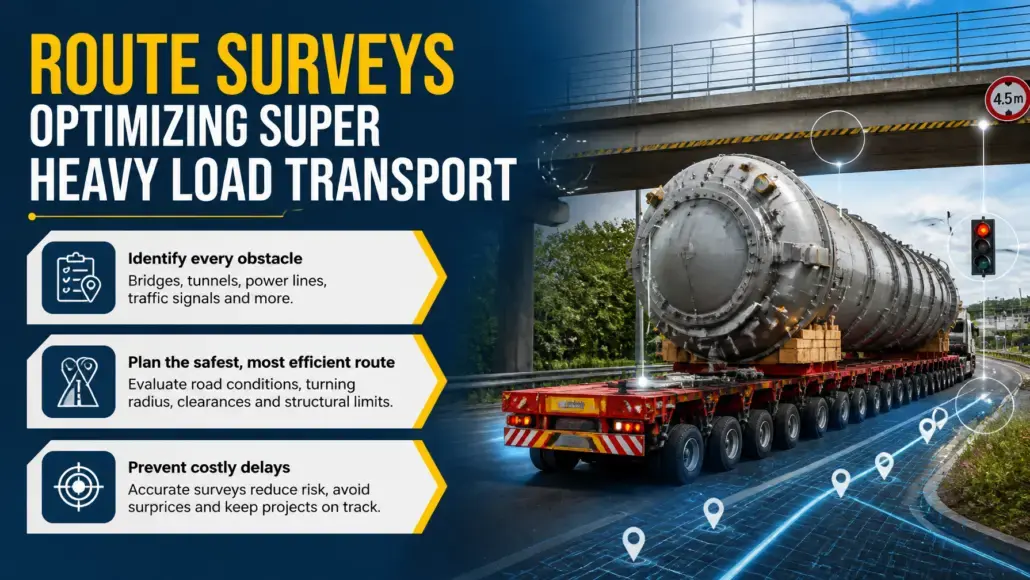
The final and often most difficult leg of a heavy lift project occurs on land. Moving a thousand ton asset through a populated area or across rural highways requires a level of planning that borders on the surgical. Every bridge, tunnel, power line, and traffic light represents a potential obstacle that could halt a multi-million dollar shipment. This reality has placed a major emphasis on optimizing super heavy load route surveys. These surveys are no longer just about taking measurements with a tape measure but involve the use of advanced mapping technologies to create a high-fidelity digital representation of the entire transport corridor.
In commercial execution, specialized heavy-transport leaders are operationalizing these technologies at scale. For instance, Mammoet expanded its proprietary Move3D and digital engineering suite across 2025–2026 to execute complex route studies and infrastructure bypass modeling for major energy transitions, such as European green hydrogen megaprojects.
The process of optimizing super heavy load route surveys is essential for identifying clashes where the cargo might physically strike an object. By using mobile laser scanning and high-resolution cameras, survey teams can capture millions of data points every second, creating a point cloud that represents the world in three dimensions. This data is then used to simulate the movement of the specific trailer and cargo configuration through the route. If the simulation shows that a bridge is two centimeters too low, the team can plan a bypass or coordinate the temporary removal of the obstacle long before the actual transport begins.
The Role of LiDAR and Digital Twins
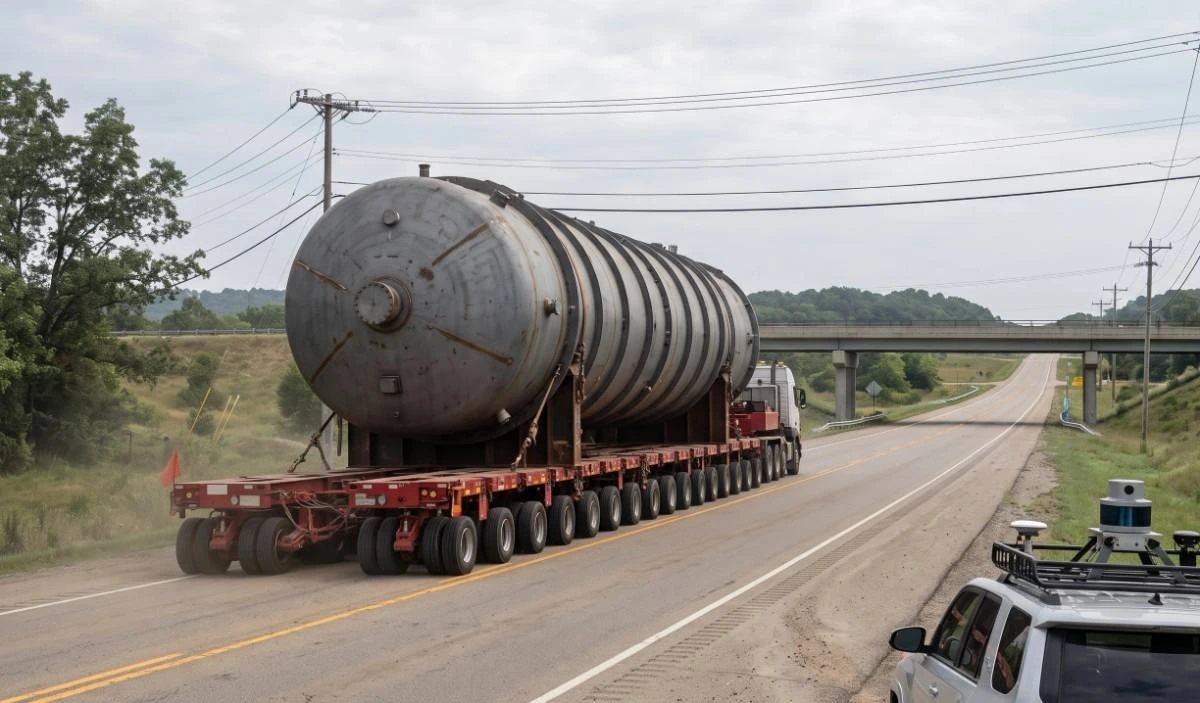
The cornerstone of modern surveying is LiDAR, which stands for Light Detection and Ranging. By mounting LiDAR sensors on a vehicle and driving the proposed route at highway speeds, logistics teams can map hundreds of kilometers in a fraction of the time required by traditional methods. This efficiency is a major factor in optimizing super heavy load route surveys for large scale projects with tight deadlines. The resulting data is used to build a digital twin of the route, allowing project managers to drive the shipment virtually and identify potential risks from the safety of their office.
Demonstrating this trend, Sarens accelerated its investments throughout 2025 and 2026 into high-precision technical surveying tools and digital-twin transport modeling. Sarens’ engineering units increasingly utilize vehicle-mounted laser-mapping datasets to simulate clearance tolerances for gigawatt-scale wind farm components and nuclear module movements across challenging European and Asian transport corridors.
Digital twins offer more than just a 3D view of the road:
- Multi-Layered Data Integration: Route planning layers bridge weight limits, road shoulder soil stability, and live traffic conditions into a single operational view.
- Comprehensive Risk Management: Combining diverse spatial and environmental datasets transforms route surveys into rigorous risk mitigation workflows.
- Precision Structural Engineering: Engineers calculate exact stress points on bridges to verify load tolerances and plan temporary structural reinforcements where needed.
- Overcoming Infrastructure Limits: Deep analytical modeling enables the safe transit of unprecedented super-heavy cargo across legacy roads and bridges never originally engineered for such loads.
Managing Civil Engineering and Public Utility Obstacles
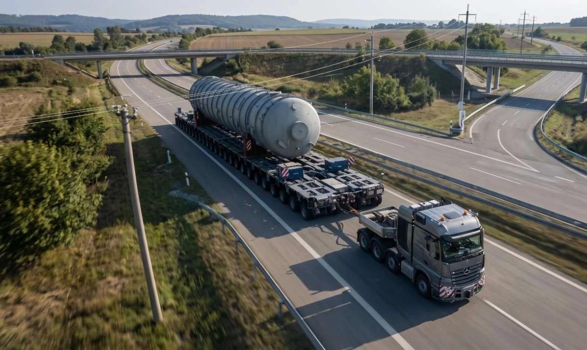
One of the most complex parts of an inland journey is the coordination with public utilities. Power lines often need to be raised or temporarily disconnected to allow for the passage of a high-clearance load. By optimizing super heavy load route surveys, companies can provide utility providers with the exact height and width of the load at every point on the route. This precision allows the utility teams to plan their work more efficiently, minimizing the disruption to local residents and reducing the total cost of the transport.
Global transport engineering giant Fagioli advanced its integration of 3D clash-detection survey data with municipal utility databases between 2025 and 2026. By feeding millimeter-accurate LiDAR scans of overhead lines and pinch points directly into shared utility portals, their engineering teams automated joint utility-lifting schedules for super-heavy electrical transformers and petrochemical towers.
Furthermore, civil engineering modifications are sometimes required, such as the temporary removal of median strips or the construction of reinforced jump bridges over sensitive underground pipes. The data gathered during the survey is used to design these temporary structures with high accuracy. The precision of a modern route survey is the final piece of the puzzle, ensuring that the strategies developed for optimizing multi modal freight for heavy equipment are translated into a safe and successful arrival at the project site. This bridge between maritime and inland logistics is where the ultimate success of the project is determined.
Dynamic Surveys and Real Time Adjustments
The physical world is not static. Road construction, new utility installations, and even the growth of trees can change the clearances on a route in a matter of weeks. Consequently, optimizing super heavy load route surveys often involves a verification drive just days before the actual shipment. During this drive, the team uses mobile mapping to check for any new obstacles that were not present during the initial survey. This dynamic approach to risk management is essential for ensuring that there are no surprises on the day of the transport.
Addressing these continuous environmental shifts, project cargo freight forwarder deugro (part of the deugro group) upgraded its proprietary route-simulation and visualization platforms in 2025–2026. The upgraded platforms cross-reference drone photogrammetry and mobile survey feeds against recent satellite updates, enabling rapid pre-haul clearance verifications for complex breakbulk corridors across the Americas and Asia-Pacific.
In addition to physical obstacles, the survey must also account for the dynamic behavior of the trailer itself. As a multi-axle trailer moves through a curve or over a crest, the geometry of the load changes.
Advanced survey software can simulate these movements, including the sweep of a long load as it turns a corner. By optimizing super heavy load route surveys to include these dynamic simulations, logistics providers can navigate narrow city streets and tight mountain passes with a high degree of confidence. The goal is to eliminate human guesswork and replace it with data-driven certainty.
Stakeholder Engagement and Permit Acquisition
Obtaining the necessary permits for a super heavy load is a complex administrative task that involves multiple levels of government. Authorities require detailed proof that the transport can be completed safely without damaging the infrastructure or endangering the public. By presenting the high-quality data generated through optimizing super heavy load route surveys, companies can speed up the approval process. A detailed 3D simulation is a much more convincing piece of evidence than a static map and a list of measurements.
To streamline this process, DSV expanded its specialized Heavy Lift and Project Logistics digital toolkits across 2025–2026. DSV now utilizes automated digital twins of transport corridors to submit interactive sweeps, turning radius proofs, and bridge load-distribution models directly to regional transportation ministries, dramatically cutting permit approval times.
This transparency also helps in engaging with the local community. By showing local residents and business owners the exact plan for the transport, companies can address concerns about noise, traffic delays, and safety. This proactive communication is essential for maintaining the social license to move massive assets through public spaces. The effort put into optimizing super heavy load route surveys is therefore as much about public relations and regulatory compliance as it is about engineering. The precision of a modern route survey ensures that the strategies developed for optimizing multimodal heavy equipment freight are translated into a safe and successful arrival at the project site.
Technical Limitations and Human Expertise
While technology has transformed the field, human expertise remains irreplaceable. A computer can identify a low bridge, but it takes an experienced logistics professional to decide whether to bypass it or to reinforce the structure. Furthermore, the interpretation of LiDAR data requires a deep understanding of both surveying principles and the physical realities of heavy haulage. The best results are achieved by optimizing super heavy load route surveys through a combination of cutting-edge hardware and the practical wisdom of veteran road captains.
There are also technical challenges to overcome, such as the massive amounts of data generated by 3D scanning. Managing and analyzing terabytes of point cloud data requires significant computing power and specialized software. As the industry continues to move toward more detailed mapping, the focus will be on developing more efficient ways to process and share this information among project partners. The future of optimizing super heavy load route surveys lies in cloud-based platforms that allow for real-time collaboration on the digital twin, ensuring that everyone is working from the same set of high-precision data.
The Foundation of Inland Success
The movement of super heavy loads is a feat of engineering that requires total precision from start to finish. Without a detailed and accurate route survey, the entire project is at risk of failure. Transport Advancement believes that by investing in optimizing super heavy load route surveys, companies are laying the foundation for a safe, efficient, and predictable inland journey. The integration of LiDAR, digital twins, and dynamic simulation represents the state of the art in modern logistics planning.
As we look forward, the technology will only continue to improve, with higher resolution sensors and more powerful AI-driven analysis tools. However, the core objective will remain the same: to move the world’s most massive and complex industrial assets with total safety and zero incidents. The dedication to optimizing super heavy load route surveys is what makes this possible, turning a potentially dangerous operation into a routine exercise in precision. For the professionals moving the components of our future, the route survey is the roadmap to success.
References
- “Precision Planning and Engineering Optimize Holland Hydrogen 1 Build” — Mammoet
- “Global Heavy Lift Solutions and Infrastructure Planning” — Sarens
- “Digital Engineering & Over-Dimensional Cargo Route Feasibility Reports” — Fagioli S.p.A.
- “Project Logistics Corridor Optimization & Breakbulk Routes” — deugro
- “Oversized Cargo Transportation Market Dynamics & Global M&A Integration Report” — DSV A/S
