









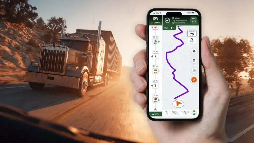
There used to be a time when navigating a truck was simply done by having a GPS device installed on the dashboard, giving directions, helping you avoid getting lost, and sometimes notifying you about a low bridge or weight limit. For a long time, it was sufficient.
Yet the trucking industry has transformed itself into something totally different now. Fleet operations are run in an environment of real-time data, vehicle connectivity, compliance in the digital world, and intricate logistics supply chains. In turn, the evolution of navigation has taken place accordingly.
Navigation that was once just a separate device is now a software solution that constantly communicates with drivers, dispatchers, and fleet management systems.
From Static Maps to Dynamic Intelligence
The original truck GPS devices had only one main task – to calculate routes safe for commercial trucks.
Compared with consumer navigation, this was a major improvement. Drivers could enter vehicle dimensions, gross weight, trailer size, and other restrictions to receive routes that reflected commercial vehicle limitations.
It was a significant technological leap. However, the limitations of the hardware-based model soon became apparent. Maps required manual updates, traffic information could be delayed, and navigation systems typically operated separately from the rest of a company’s technology stack.
Modern truck navigation demonstrates how different the model has become.
For example, Trucker Guide combines truck-specific navigation with a database of more than 450,000 points of interest for truckers, covering truck stops, parking, fuel, weigh stations, repair services, restaurants, hotels, and other locations relevant to commercial drivers.
The significance is not simply the size of the database. It illustrates the broader shift from navigation as a digital map to navigation as an operational information layer.
Smartphones Changed More Than the Screen
The emergence of smartphones was not just a substitution of one kind of interface by another. It opened entirely new possibilities for the development and delivery of navigation software solutions.
Applications could connect to cloud services and receive updates continuously all day long. Information about new roads, construction sites, traffic conditions, and any software changes was no longer linked to the installation of additional hardware and downloading of map packages.
Such an approach made the innovation process much faster since features, which previously would take years to be available in specialized GPS devices, became available in the course of application updates.
Trucker Guide is a useful example of this model. Its navigation platform combines truck-safe routing with more than 17,000 live road cameras, parking availability, weather information, weigh-station status, fuel prices, and access to hundreds of thousands of truck-relevant locations.
The live-camera network is particularly representative of the difference between old and modern navigation. Instead of relying only on a map that describes the road, drivers can access current visual information about traffic and road conditions before making a routing decision.
For fleet managers, it meant quick introduction of new functionalities without purchasing additional hardware installed in the vehicle.
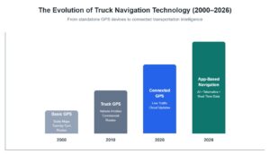
Navigation Became Part of a Connected Ecosystem
Probably the most significant shift has been in relation to the place navigation has within the larger digital fleet ecosystem.
Today’s transportation companies don’t consider navigation an individual app. Navigation works together with telematics, ELDs, TMS, maintenance systems, and dispatch systems.
The information exchange happens in two ways. Navigation gets information while simultaneously providing crucial information on the vehicle’s whereabouts, ETAs, delays, and other information.
The effect of all that is increased transparency in transport operations.
| Then: Hardware GPS | Now: App-Based Navigation |
| Standalone device | Connected software platform |
| Periodic map updates | Continuous cloud updates |
| Fixed functionality | Regular feature releases |
| Limited operational data | Live operational intelligence |
| Independent operation | Integrated fleet ecosystem |
Trucker Guide’s usage data also illustrates the scale that app-based navigation can reach. It has more than 2 million monthly search requests, alongside a 4.8 app rating. Those figures suggest that modern truck navigation is increasingly being used as an information platform rather than simply as a digital replacement for a paper map or dedicated GPS unit.
Rather than existing as a separate tool, navigation has become one component of a connected digital workflow.
Context Is Becoming More Valuable Than Directions
One of the most important innovations is that the navigation technology is contextual and not just distance-based.
A contemporary system takes into account many more factors than road configuration. The list includes the following:
- Commercial vehicle restrictions
- Live traffic conditions
- Road construction
- Severe weather
- Truck parking availability through features such as a truck stop finder app
- Fuel locations and pricing
- Vehicle dimensions
- Hours of Service requirements
All of these factors impact decision-making operations. The goal now is not to find the shortest path but to find a route that offers a balance between efficiency, compliance, safety, and cost.
Trucker Guide provides a practical example of this broader approach. In addition to truck-specific routing, the platform brings parking, weather, fuel information, weigh-station status, and other truck-relevant locations into the same navigation environment. This means that navigation can support decisions around a trip, not just the route itself.
Even for fleets comprising hundreds of vehicles, minor enhancements in decision-making with regard to routes can offer tangible benefits.
Cloud Architecture Enables Continuous Improvement
The cloud native nature of this software has revolutionized the way in which transportation technology evolves.
Traditionally, navigation systems were limited in their functionality based on what was possible when they were manufactured. Modern software continues to evolve during its lifetime.
Updated algorithms, new maps, changes in the infrastructure, and integration possibilities can be made remotely without interfering with fleet operations.
This evolution model makes it easier for the navigation company to adapt to new regulations, infrastructure works, and user demands.
In turn, this saves costs on software management and deployment for the technology team operating the fleet.
Artificial Intelligence Will Shape the Next Generation
Artificial intelligence is progressively turning navigation from a reactive tool into a predictive tool.
AI models allow us not only to react once there is an issue but also to predict possible disturbances using information about traffic trends, weather conditions, deliveries, and previous trips, among others.
These features keep growing. Emerging AI applications include:
- Predictive arrival time calculations
- Intelligent rerouting before delays develop
- Personalized route recommendations
- Risk assessment based on weather and road conditions
- Operational insights for dispatch teams
Instead of simply answering the question, “Where should the driver go?” navigation platforms are beginning to answer, “What is the best operational decision at this moment?”
The development of large truck-specific data environments is an important part of this transition. A navigation platform that combines routing with live cameras, parking information, weather, fuel locations, and hundreds of thousands of truck-relevant points of interest has considerably more operational context available for future predictive features than a traditional standalone GPS device.
Mobility Is Replacing Dedicated Hardware
Use of mobile apps has also affected the use of technology in fleets.
The organization does not have to spend money on purchasing navigation tools for each vehicle separately. Drivers gain access to the frequently updated software from their smartphone or tablet devices.
There are various benefits of using this technique.
| Hardware-Based Systems | Mobile Applications |
| Separate device required | Uses existing mobile hardware |
| Manual software maintenance | Automatic updates |
| Hardware replacement for major upgrades | Continuous software evolution |
| Higher deployment costs | Easier fleet-wide adoption |
The flexibility of mobile platforms has accelerated technology adoption across fleets of all sizes, from independent owner-operators to national carriers.
Trucker Guide illustrates this transition particularly well because the application combines the flexibility of mobile software with a truck-specific information layer that includes live parking information, road cameras, weather, fuel data, weigh-station information, and truck-safe routing.
The important point is that the smartphone itself is no longer the technology story. The value comes from the software and data operating on top of it.
The Road Ahead
The development of navigation technology has continued along with the development of other areas in connected transportation.
As vehicles produce greater amounts of operational data, navigation applications are anticipated to become better integrated with predictive maintenance systems, charging systems for electric vehicles, freight marketplaces, and vehicle-to-everything (V2X) communications. Navigation systems will be able to make routing decisions based not just on the road conditions but on the state of a vehicle, its power needs, and overall traffic patterns as well.
These changes can already be observed across the truck navigation app market. Modern platforms are moving beyond basic routing by combining navigation with parking information, weather, fueling services, road conditions, and other operational tools. The result is a broader shift toward navigation as a connected operational platform rather than a standalone application.
Moving from dedicated GPS devices to apps is not just about upgrading one’s technology. It is rather a signal of the change in the way transportation companies are making their decisions.
As navigation systems continue to incorporate different kinds of data and integrate with other connected fleet technologies, their usefulness will not depend on their ability to navigate alone, but on their ability to help drivers and companies make better operational decisions throughout the entire trip.
