


















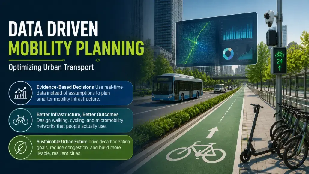
The global transition toward sustainable urbanism has elevated active mobility from a peripheral urban planning consideration to a central pillar of resilient city infrastructure. As municipalities strive to meet ambitious decarbonization targets, the integration of walking, cycling, and micromobility into the broader transport tapestry has become non-negotiable. However, the traditional methods of infrastructure deployment—often based on anecdotal evidence or static, infrequent surveys—are no longer sufficient to address the dynamic complexities of modern metropolitan environments. Today, the sector is witnessing a paradigm shift as active mobility networks gain significant momentum from data driven mobility planning. Transport Advancement notes that by leveraging granular, real-time insights from a multitude of digital sources, urban planners are now able to design networks that are not only more efficient but also inherently safer and more responsive to the actual needs of the citizenry.
The Evolution of Active Transport Through Granular Analytics
Historically, the planning of cycle lanes and pedestrian pathways suffered from a lack of high-fidelity usage data. Unlike motorized vehicle traffic, which has long been monitored via pneumatic tubes and induction loops, active travel remained largely invisible to the analytical eye. This data vacuum often led to the build it and they will come philosophy, which frequently resulted in underutilized infrastructure or critical gaps in connectivity. The emergence of data driven mobility planning has effectively dismantled these barriers. By aggregating data from GPS-enabled smartphones, fitness tracking applications, and public bike-share systems, planners can now visualize heatmaps of actual movement patterns. This shift allows for a more nuanced understanding of where people are walking and cycling, rather than where planners assume they should be.
The depth of this data extends beyond mere volume; it encompasses temporal and environmental variables that were previously impossible to capture at scale. For instance, understanding how weather conditions or time-of-day fluctuations impact route choice allows for the implementation of dynamic infrastructure solutions, such as intelligent lighting or seasonal maintenance prioritization. This analytical rigor ensures that every dollar of public investment is backed by evidence, maximizing the utility of the built environment.
Bridging the Infrastructure Gap with Predictive Modeling
One of the most profound benefits of data driven mobility planning is its ability to predict future demand rather than simply reacting to past trends. Predictive modeling, powered by machine learning algorithms, can simulate the impact of new developments or transit interventions on active travel behavior. When a city plans a new metro station, for example, data driven mobility planning can identify the most effective last-mile connections, ensuring that the surrounding active mobility network is ready to handle the influx of commuters from day one. This proactive approach prevents the congestion and safety issues that typically arise when infrastructure lags behind demand.
Furthermore, these models can identify hidden demand—routes where people would walk or cycle if the infrastructure were safer or more continuous. By analyzing detours and near-miss data from connected sensors, planners can pinpoint exactly where the existing network fails the user. Solving these connectivity gaps is essential for creating a cohesive active mobility network that rivals the convenience of private vehicle ownership.
Enhancing Safety and Accessibility Through Precision Engineering
Safety remains the primary deterrent to the widespread adoption of active travel. The perceived risk of navigating urban environments alongside heavy motorized traffic is a significant barrier for diverse demographic groups, including children and the elderly. Data driven mobility planning addresses this by providing an objective assessment of risk profiles across the network. High-resolution crash data, combined with telematics that track sudden braking or swerving maneuvers by cyclists, allows for the identification of dangerous intersections long before a fatal incident occurs.
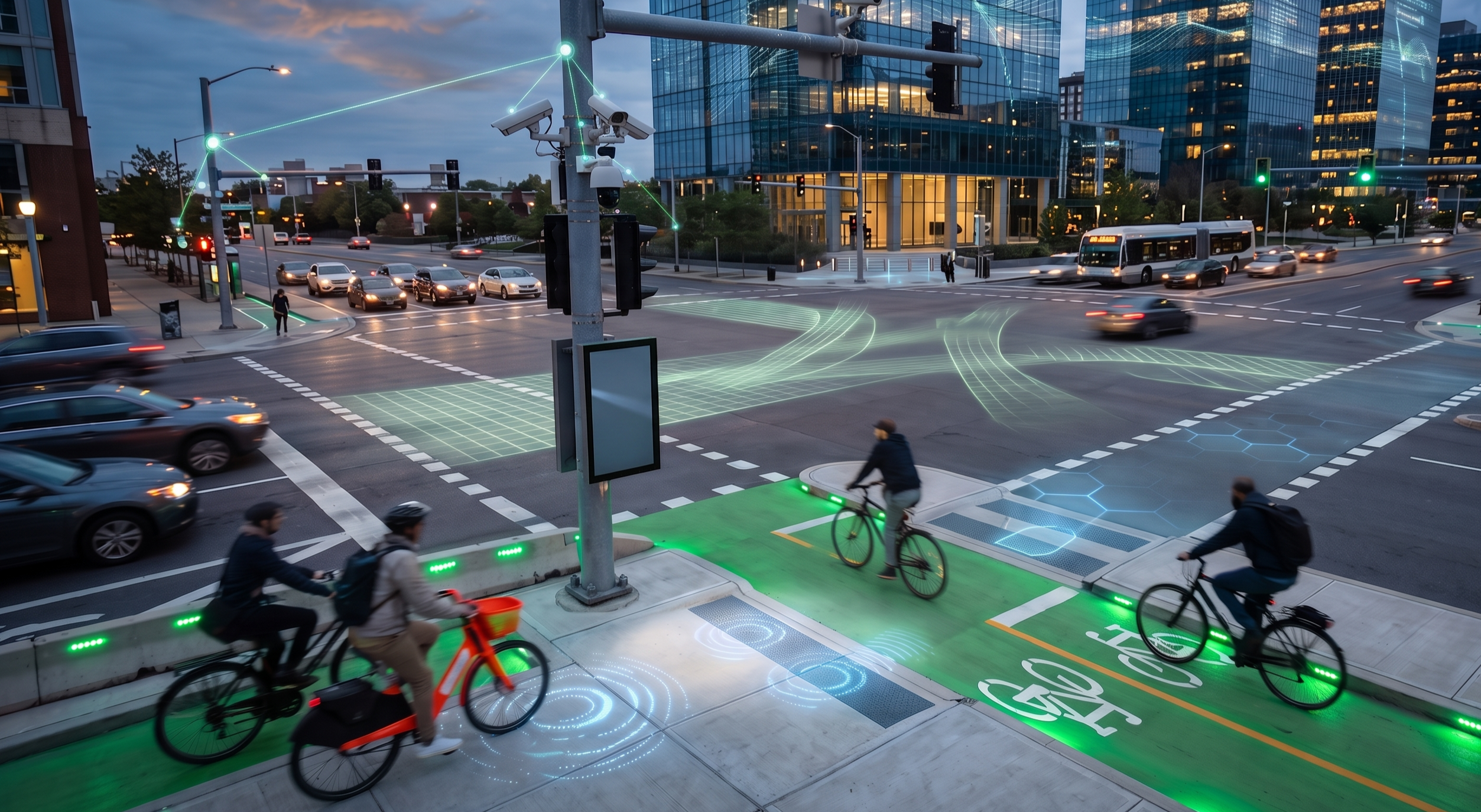
By focusing on these black spots, cities can implement targeted interventions, such as protected intersections, narrowed carriageways, or adjusted signal timings. This transition from reactive safety measures to a culture of preventative precision engineering is a hallmark of the modern data-led approach. When safety is treated as a measurable metric rather than a subjective feeling, the resulting infrastructure is naturally more inclusive and inviting for all users.
The Role of IoT and Real-Time Feedback Loops
The integration of the Internet of Things (IoT) into the urban fabric has created a living laboratory for active mobility. Smart bollards, light sensors, and air quality monitors provide a constant stream of information that feeds back into the planning process. This real-time feedback loop allows for the fine-tuning of active mobility networks in ways that were previously unimaginable. For example, if data indicates a sudden spike in cyclist volume on a particular corridor, traffic management systems can automatically adjust signal priority to favor active travelers, reducing wait times and improving the overall experience.
Moreover, this technology enables a more participatory form of urban planning. Digital platforms allow citizens to report maintenance issues or suggest improvements directly through their mobile devices, with these inputs being geographically tagged and integrated into the data driven mobility planning framework. This democratization of data ensures that the network evolves in alignment with the lived experience of the people who use it every day.
Economic and Environmental Dividends of Data-Led Strategies
The shift toward data driven mobility planning is not merely a technical exercise; it is an economic imperative. Cities that prioritize active travel see a measurable reduction in healthcare costs due to improved public health outcomes, as well as a decrease in the economic burden of traffic congestion. Furthermore, well-planned active mobility networks have been shown to boost local commerce, as pedestrians and cyclists are more likely to stop at local shops compared to motorists. Data analytics allow cities to quantify these benefits, providing a robust business case for continued investment in sustainable infrastructure.
From an environmental perspective, the ability to accurately measure the carbon displacement of active travel is crucial for reporting against climate goals. By demonstrating the effectiveness of specific interventions in shifting modal choice away from internal combustion engines, planners can secure additional funding from international climate funds and green bonds. The transparency provided by data driven mobility planning builds trust with stakeholders and the public, ensuring the long-term viability of these projects.
Integrating Artificial Intelligence in Mobility Planning
As we look toward the next decade, the role of artificial intelligence in data driven mobility planning will only expand. AI-driven generative design tools can now propose entire network layouts that optimize for a multitude of variables simultaneously, such as shade coverage, slope gradient, and connectivity to public transit hubs. These tools can process vast datasets, including satellite imagery and topographical maps, to find the most efficient and cost-effective routes for new cycle superhighways. AI can thus help with smart mobility processes such as smart depot transit.
Overcoming the Digital Divide in Planning
While the potential of data driven mobility planning is immense, it is crucial to address the potential for digital bias in the planning process. Not all demographics are equally represented in smartphone or fitness app data; lower-income residents, the elderly, and children may be invisible to certain digital datasets. To ensure that active mobility networks are truly inclusive, planners must supplement big data with traditional qualitative methods, such as street-level observations and community workshops. A hybrid approach—combining the scale of digital analytics with the depth of human experience—is the gold standard for modern urbanism.
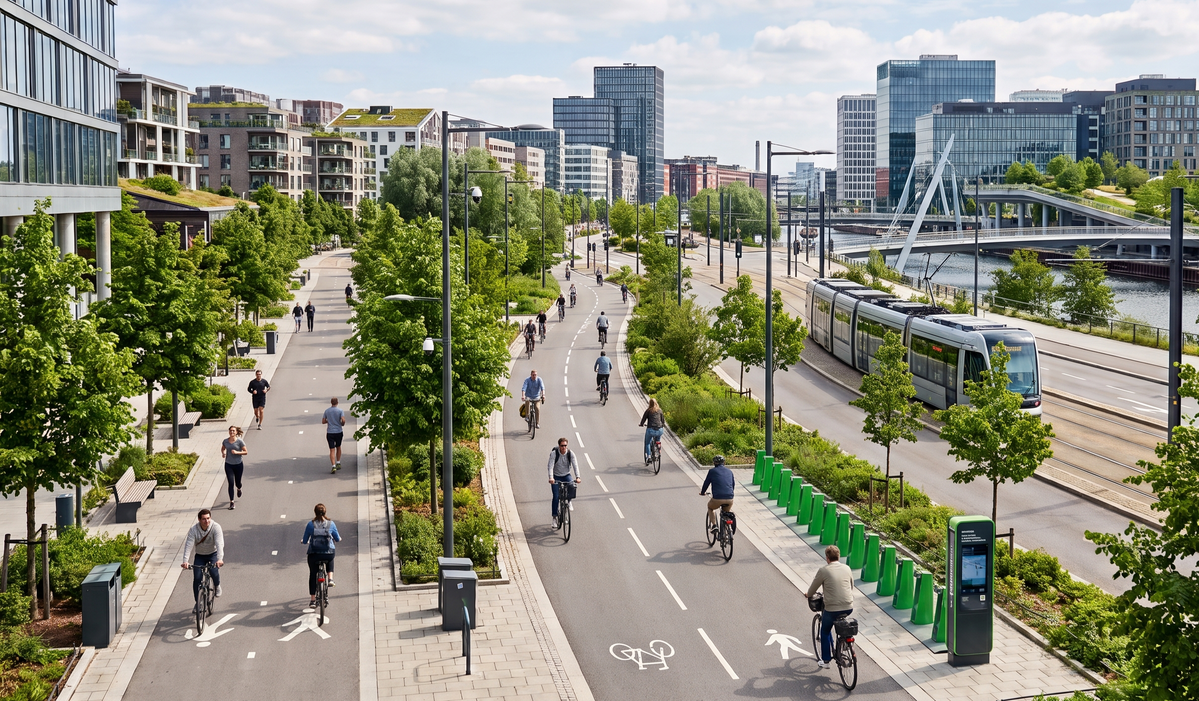
Furthermore, the protection of data privacy is a non-negotiable requirement. As cities collect more granular information about how people move, they must implement robust anonymization and encryption protocols to protect individual identities. The trust of the citizenry is the most valuable asset in any data driven mobility planning initiative. Without this trust, the ability to collect and use data will be curtailed by regulatory and social pushback. Transparency about what data is being collected and how it is being used to improve the community is essential for long-term success.
The ultimate goal of data driven mobility planning is the creation of a seamless, multi-modal ecosystem where active travel is the most convenient and natural choice for urban residents. Transport Advancement believes that by moving beyond the limitations of static planning and embracing the dynamic potential of digital intelligence, cities can build active mobility networks that are truly fit for the future. The success of these networks will be measured not just by the kilometers of pavement laid, but by the safety, health, and happiness of the communities they serve. As we refine these tools, the distance between the planning office and the pavement will continue to shrink, resulting in cities that are built for people, not just for machines.
